UP NEXT
A devastating outbreak of tornadoes that swept through parts of the Midwest and Tennessee River Valley on Friday night is poised to become the worst on record to strike the United States during December.
Kentucky Gov. Andy Beshear (D) said he expects the death toll in his state alone to reach at least 70 to 100. If that is the case, it will become the deadliest December tornado outbreak on record and among the 15 deadliest in any month.
“Last night was one of the most shocking weather events in my 40 years as a meteorologist — a violent tornado (in December!) drawing comparisons to the deadliest and longest-tracking tornado in U.S. history,” tweeted Jeff Masters, a meteorologist and expert on extreme weather.
Live updates: Tornado kills more than 70 people in Kentucky, governor estimates
The National Weather Service received 37 reports of tornadoes in six states Friday. The most destructive tornado, or series of tornadoes, carved an approximately 250-mile path through northeast Arkansas, southeast Missouri, northwest Tennessee and western Kentucky.
Should it be confirmed as single, continuous tornado rather than a series of twisters, the “quad-state tornado” would rank as the longest-track tornado in U.S. history and the first to track across four states.
The National Weather Service reported that the storm lofted debris into the sky for over three straight hours, and the Weather Service declared a tornado emergency in eight different locations; such alerts are issued only when a large, violent tornado threatens highly populated areas.
As the tornado blasted through Mayfield, Ky., it sheared entire homes off their foundations and lofted debris more than 30,000 feet into the air, indicative of a twister of top-tier intensity. The Weather Service will survey damage over the weekend to assign the tornado a specific rating on the zero-to-5 Enhanced Fujita (EF) scale.
In addition to the quad-state storm, destructive and deadly tornado activity erupted in Illinois and there was one report of a twister in northern Mississippi.
More than 18 million people were under tornado watches amid the outbreak, and the Weather Service issued 146 tornado warnings, the most on record during December.
Fueled by record-setting warm temperatures, the disaster was unprecedented in many ways for the time of year and is raising questions about the possible role of human-caused climate change.
How the event came together
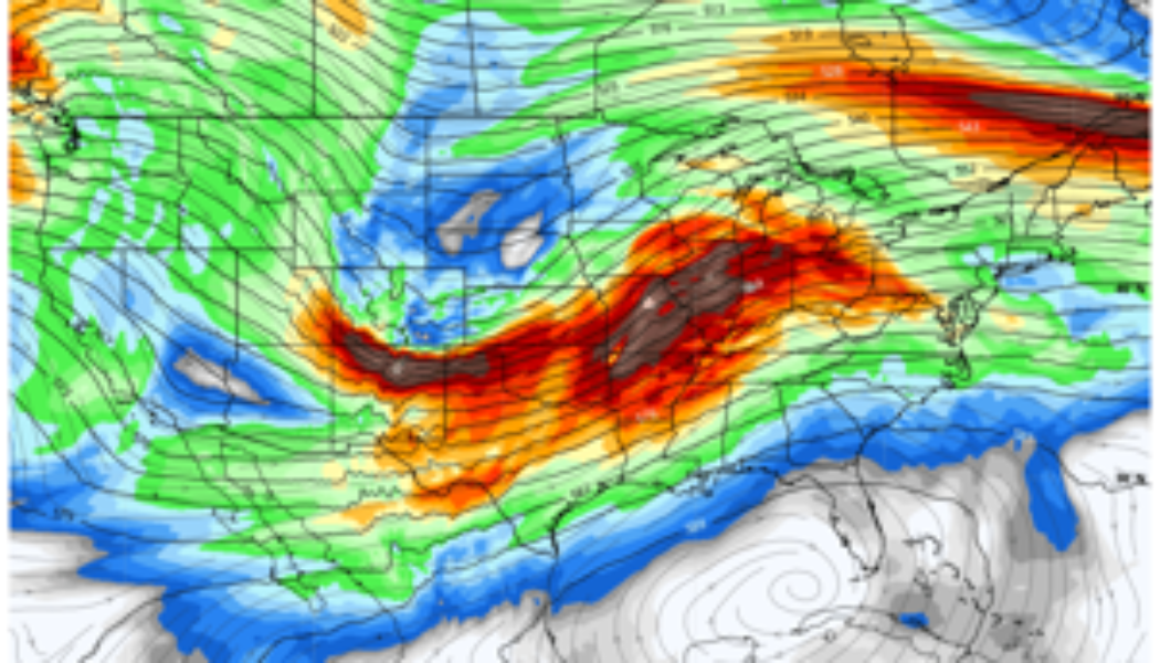
The event was triggered by a powerful low-pressure system that lifted from the Southern Plains into the Great Lakes. The low-pressure intensified as the polar jet stream, the high-altitude current along which storms track, plunged into the central United States ahead of a pulse of record-setting warmth. The same system ended a record-setting snowless streak in Denver and unloaded a foot of snow in Minneapolis.
An active jet stream over the U.S. Friday night. (weatherbell.com)

As a cold front attached to the zone of low pressure encountered the exceptionally warm, unstable air Friday evening, numerous thunderstorms erupted. With temperatures in the 70s to near 80, “[t]he atmosphere didn’t know it was December,” tweeted Craig Ceecee, a researcher in meteorology at Mississippi State University. Memphis soared to 79 degrees, 26 degrees above average, one of dozens of locations that reached record-high temperatures.
Meanwhile, powerful winds at the jet stream level blew from a different direction than those lower to the ground, helping the thunderstorms rotate or become supercells.
The rotating thunderstorm that spawned the quad-state tornado(es) developed from a cluster of storms over central Arkansas. These storm cells congealed to the east of the cold front, separate from any other storms that could compete for available energy or disrupt them.
While passing through northeast Arkansas, the quad-state storm encountered an increasingly favorable tornadic environment, with extreme spin-inducing low-level winds.These ingredients remained in place as it tracked about 250 miles into western Kentucky.

The Weather Service in Memphis issued the first tornado warning for the storm at 7:06 p.m. Central time, stating that a “confirmed large and extremely dangerous tornado” had formed. The storm moved over Monette, Ark., where it severely damaged a nursing home, at 7:24 p.m. Central time.
“This is a PARTICULARLY DANGEROUS SITUATION,” the Weather Service wrote. “TAKE COVER NOW.”
Meteorologists observed an intense velocity “couplet” on radar, in which air racing in one direction clashes with air racing in another. A sign of rotation, the couplet seen on the quad-state storm was among the strongest observed by modern radar.
The storm may have “cycled” once while passing over northwest Tennessee, a process in which the initial tornado dissipates and a new one develops. But by the time the storm hit Mayfield at 9:27 p.m., the radar signature again indicated a devastating tornado.
Aside from the extreme rotation indicated by radar wind data, a dramatic debris signature was seen as the storm approached the Kentucky city.
Not until after 11:30 p.m., when the storm was southwest of Louisville, did it stop rotating.
The strength of the quad-state tornado
Although intensity estimates could take many days to finalize, the radar signature was at times indicative of a violent twister, or an EF4 or EF5.
If rated an EF5, it would end a record eight-year absence of such top tier tornadoes. It would be the first EF5 since the devastating Moore, Okla., tornado on May 20, 2013, and the first of such intensity in December since 1957.
If the tornado is rated at least EF4, it would be the first in the region in December since 2015, when a twister hit near the border of Mississippi and Tennessee. It would also be just the second EF4 tornado of 2021 in the United States, while a typical year produces seven EF4 or stronger tornadoes.
The path may have been historically long
There have been only 59 previous tornadoes with path lengths of 100 or more miles since 1950. That shrinks to 12 for path lengths of 150 miles or greater. During the Super Outbreak of 2011, there were three such tornado paths, the last such instances.
Tornado tracks of 100+ miles since 1950. (TornadoArchive.com)

The longest paths on record top 200 miles, with caveats. A 235-mile track in March 1953 is the modern record holder, according to data from the Storm Prediction Center data. Since none of these tornadoes have happened since 1971, it is certainly possible some of them were tornado families, or cyclic tornadoes forming one after another, rather than one long-track event.
The 219-mile-long Tri-state Tornado of March 1925 is also considered the longest tornado path by many sources. The deadliest tornado in U.S. history, it killed 695 people as it passed through Missouri, Illinois and Indiana during the overnight hours.
This event’s path length could exceed that. However, Rick Smith, a meteorologist at the Weather Service office in Norman, Okla., tweeted that the quad-state tornado was more likely a series of twisters than just one. On-the-ground surveys to sort this out may be “a complex process that could take some time,” Smith wrote.
Even if the damage was caused by more than one tornado, the longevity of the intense supercell is unusual for any time of year, and probably is unprecedented for December.
Victor Gensini, a professor of meteorology at Northern Illinois University who has published studies on links between climate change and severe storms, said in an email that events like this may become more common in a warming world.
“[I]t’s absolutely fair to say that the atmospheric environments will be more supportive for cool-season tornado events,” he wrote in an email.
Exceptionally deadly
Meteorologists fear nighttime tornadoes the most, as they are the most deadly. People may be sleeping or lack the visual cues of twisters that approach during daylight. Considering the likelihood of at least 70 fatalities, Friday night’s outbreak was a testament to the peril of nocturnal storms.
Before Friday night, only 14 tornado fatalities had occurred in 2021, a below-average number. Previously, the deadliest December tornado occurred on Dec. 5, 1953, when 38 people were killed in Vicksburg, Miss.
Both of these numbers are expected to be easily surpassed. And this tornado event is likely to be the deadliest in Kentucky history.
It appears likely that this tornado will be the deadliest since the infamous Joplin tornado in May 2011, which killed 158 people.
In the modern record, since 1950, only 10 tornadoes have caused 50 or more deaths. Three of these happened in April 2011. Before that, they all occurred before 1971.
The high death toll for this event occurred despite timely warnings from the Weather Service.
Roger Edwards, a tornado expert at the Weather Service, tweeted that a significant death toll was practically unavoidable, given the tornado’s ferocity.
“When a violent wedge tornado engulfs a densely populated area, devastation is assured. Even the very best warnings only minimize, not eliminate, casualties,” he wrote.
Join Our Telegram Group : Salvation & Prosperity