:max_bytes(150000):strip_icc()/downie-3cf6f77b054c4a579e2f9b019c8390fc.jpg)
Imagine a raindrop rolling off your slicker and falling to the ground. Can you picture what happens to it next?
Now you can find out not only where a raindrop goes, but you can join it on its journey to the ocean (or other large water body) with a mesmerizing interactive map called River Runner. Created with watershed data from the United States Geological Survey (USGS), the map allows one to “drop” a raindrop anywhere in the contiguous U.S. and trace its path. And it’s not just watching a blue line snake across the states. Thanks to animation created with the Mapbox map and 3D elevation data, you practically get the raindrop’s view as it flows through mountains and fields on its adventures through the watersheds.
Sam Learner
The project is the brainstorm of web developer Sam Learner, whose musing about the Rockies got him thinking about water and its journey.
“The original inspiration for the project was just thinking about the Continental Divide, particularly the east side of it, and how far water travels from there to the Atlantic,” Learner tells Treehugger.
“Being in Pittsburgh, at the confluence of three rivers got me thinking more about all of the river systems that water travels through on its way to the ocean, and so the project evolved from a simpler visualization of the path from the continental divide to the ocean into a more thorough exploration of watersheds across the country.”
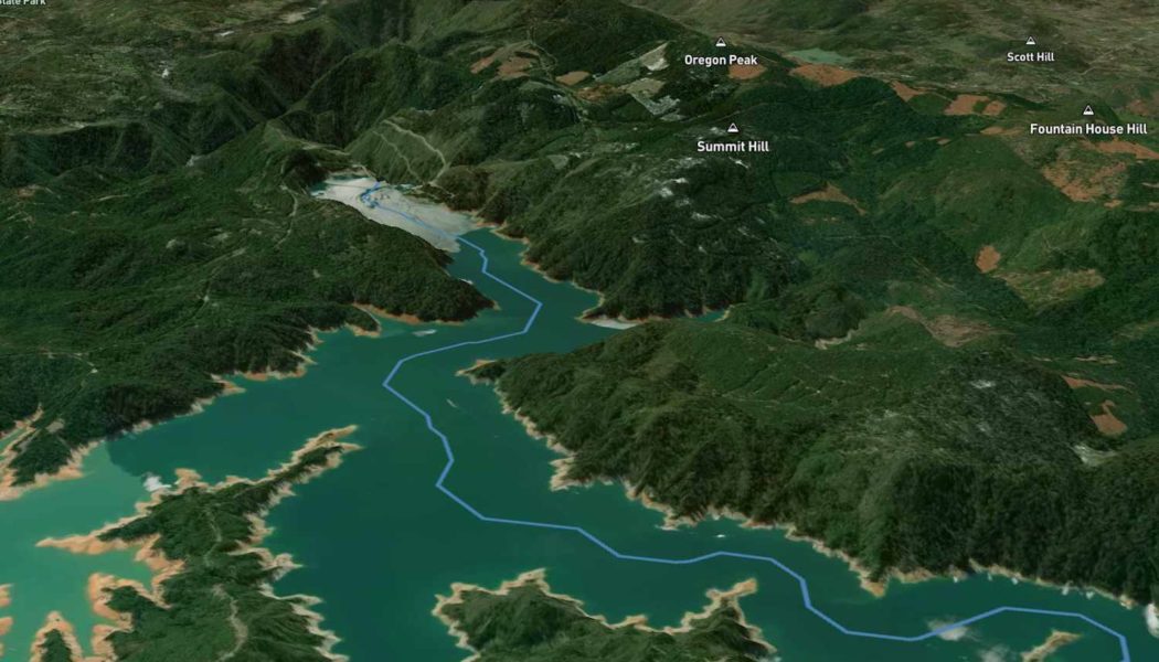
You can click anywhere on the map to drop a raindrop, or you can enter a specific location—and then the magic begins. You swoop down to the location, and then soar along the drop’s path, almost like being on a rollercoaster. A smaller inset map shows the whole route, while an information panel shows the total distance, as well as the start and finish points with the specific bodies of running water in between.
The journey of a raindrop dropped in Hiland, Wyoming.
Sam Learner
Don’t be surprised if you find yourself lost in a River Runner rabbit hole. Try your home address, a favorite vacation spot, or randomly drop a drop. It’s an oddly meditative method of armchair travel, the likes of which you’ve probably never tried before.
It is also pretty profound, at least for those of us who don’t study watersheds on a daily basis. For example, to see the 3,400-miles of creeks, streams, and rivers from Hiland, Wyoming to the Gulf of Mexico (image above) is impressive, touching 13 states along the way. We have these vast networks of running water with myriad roles to play in healthy ecosystems—yet human activity has significantly changed the water quality of U.S. rivers in the past decades. This map is great because it allows us to have a personal experience with these crucial—yet vast and somewhat abstract—water systems
“I think as I learned more about our country’s watersheds, and particularly due to the great work that USGS Water team is doing, the connectivity of everything began to resonate with me a lot more,” Learner tells us.
“I really hope that what people take away from the tool, besides a fun visual experience, is how interconnected our waterways are, and the implications of that in terms of pollutants, agriculture, or water use,” he adds. “You probably live upstream from a lot of other people.”
To play with River Runner and see more of Learner’s cool visualizations, visit his website.
Join Our Telegram Group : Salvation & Prosperity