Chile is so long, it’s curved.
How long is it?
Why not longer?
Why is no other country as thin?
How does that make Chileans incomprehensible?
All your answers in today’s article!
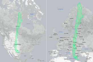
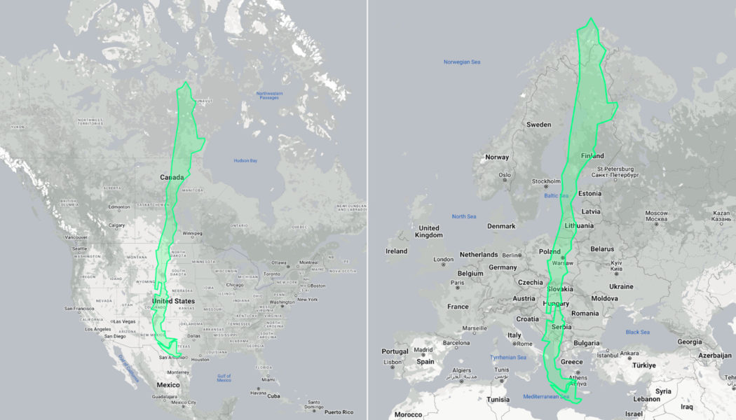
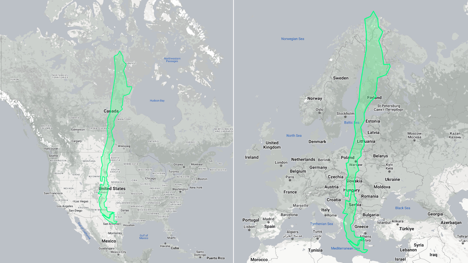
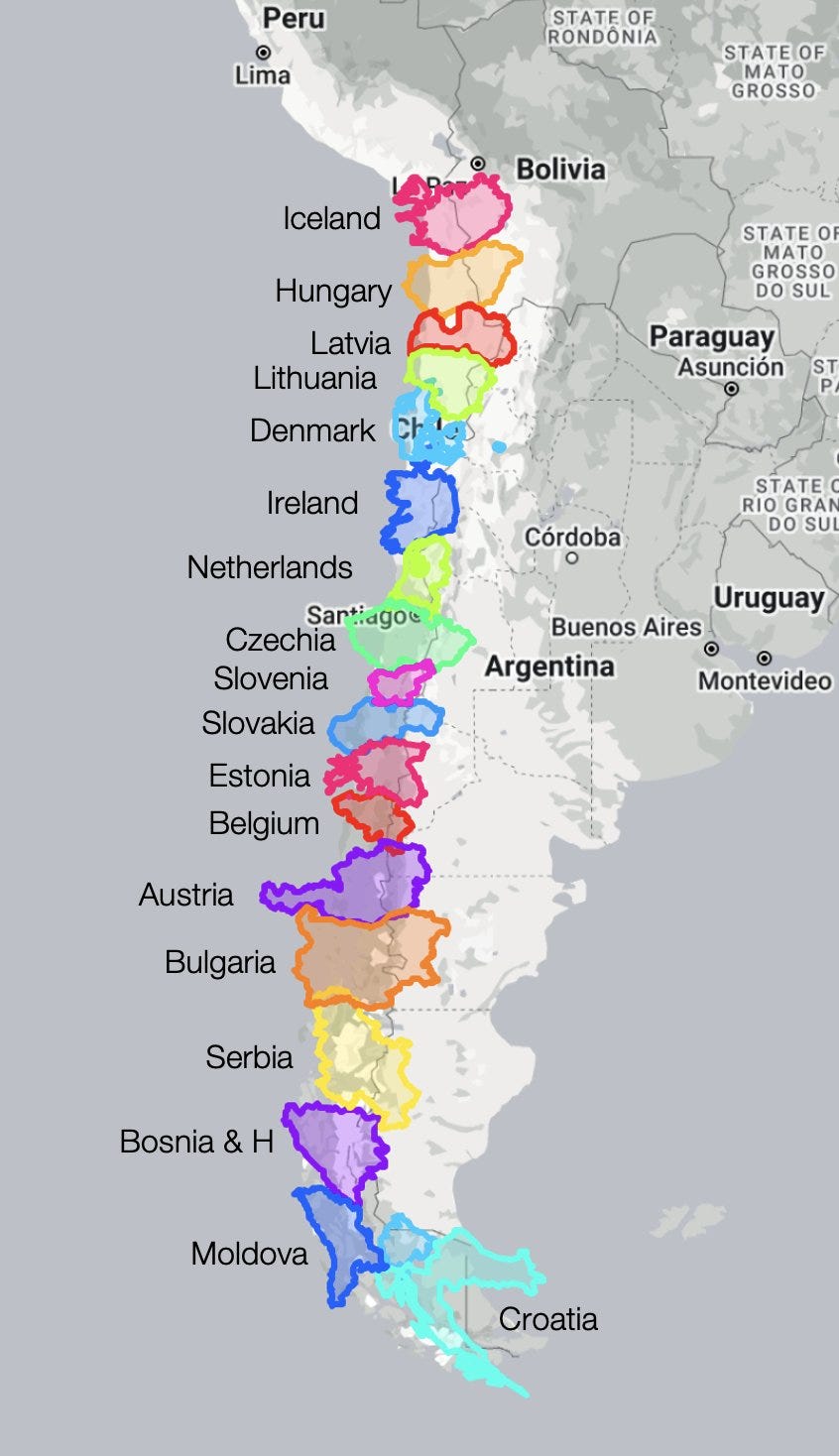
Chile is as long as the US and Canada combined.
Chile is as long as all of Europe!
It can stretch from Norway to Morocco.
From London to Baghdad!
You can stack over a dozen European countries in Chile north to south.
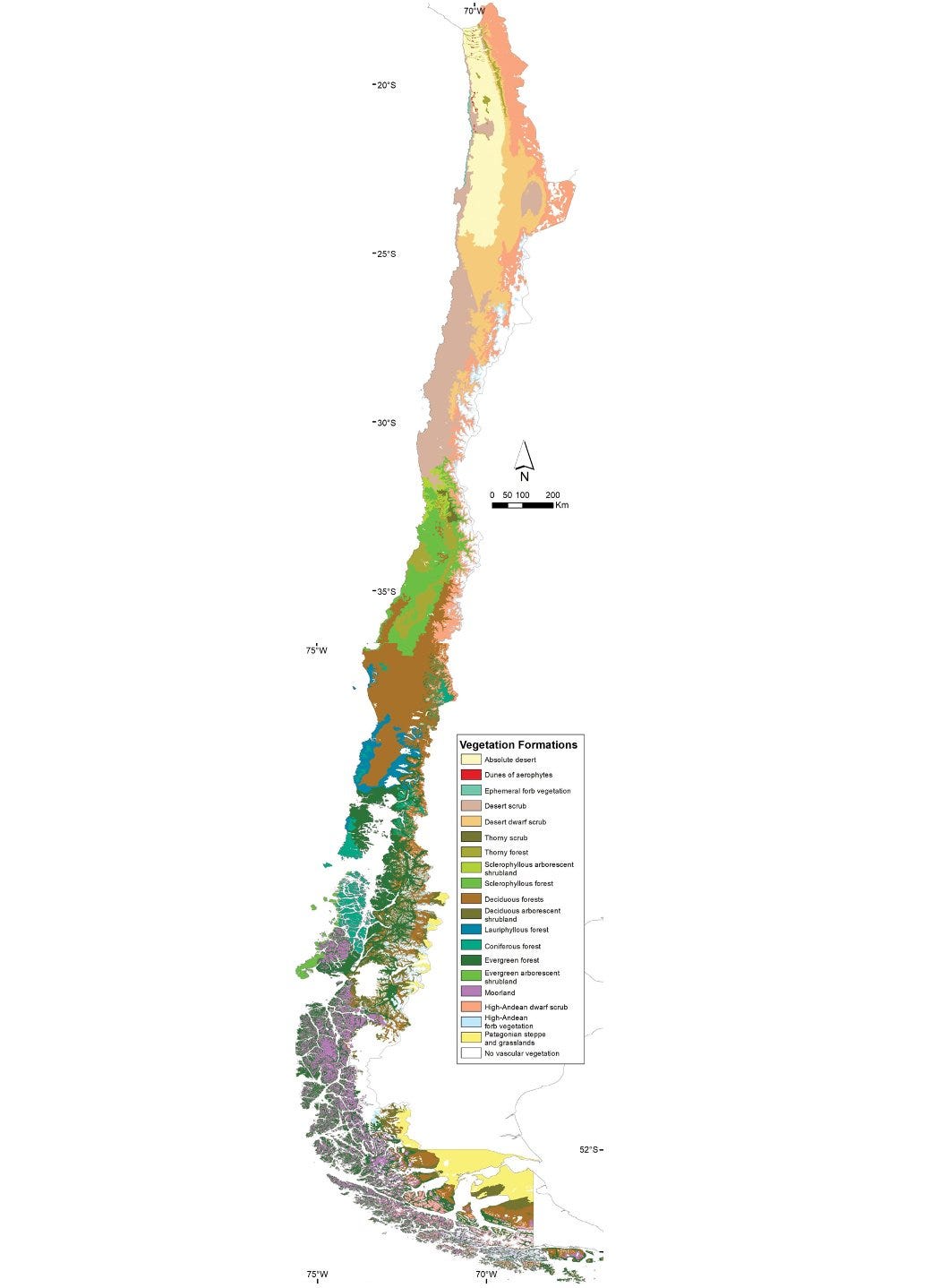
Of course, that means Chile has every possible climate.
Chile is so long because of the Andes. Here’s a map of elevation in South America.
You can’t easily pass these mountains, and the tiny sliver of land to their west is Chile.
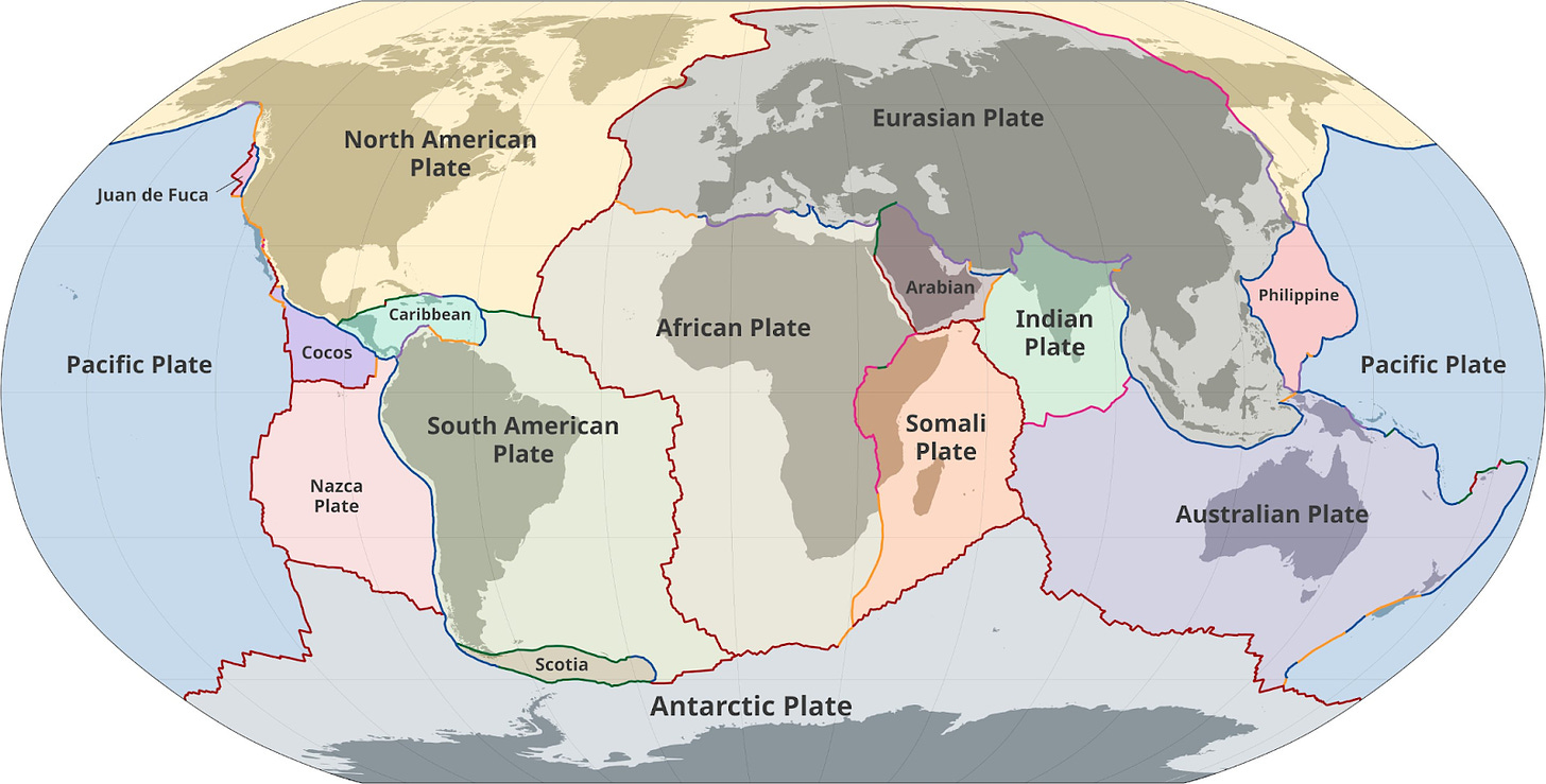
The mountains exist because of the Nazca tectonic plate hitting the South American one:
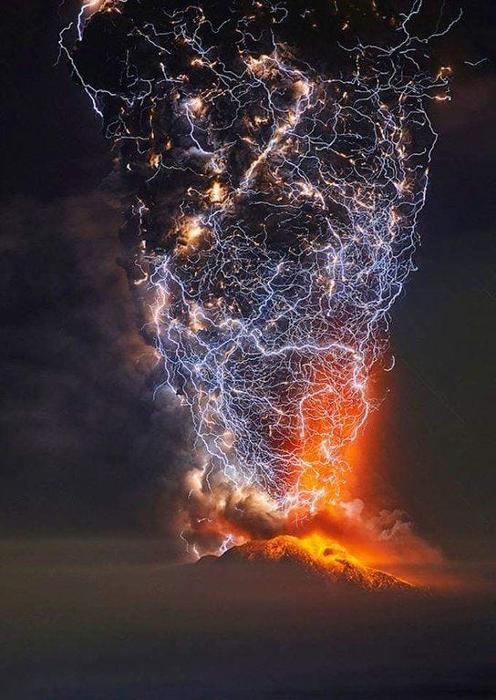
Here’s a superb (composite) image of a Chilean volcano :
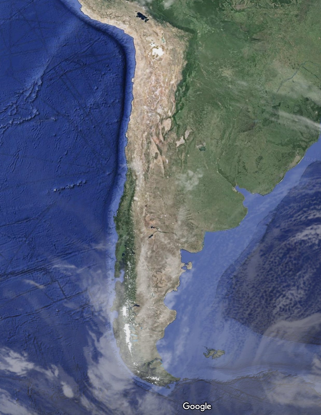
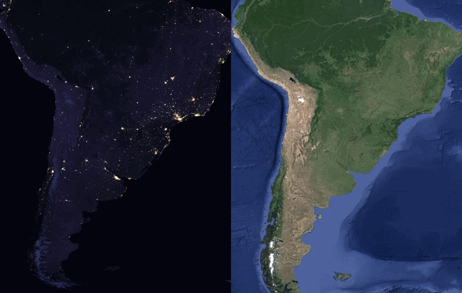
But why is Chile so long? Why not longer? You can get a sense by looking at a satellite map of the region. From it, can you guess where most Chileans live?
You can see by comparing the satellite map and the map of night lights:
Chileans live in the middle of the country, in the northern part of the green stripe.
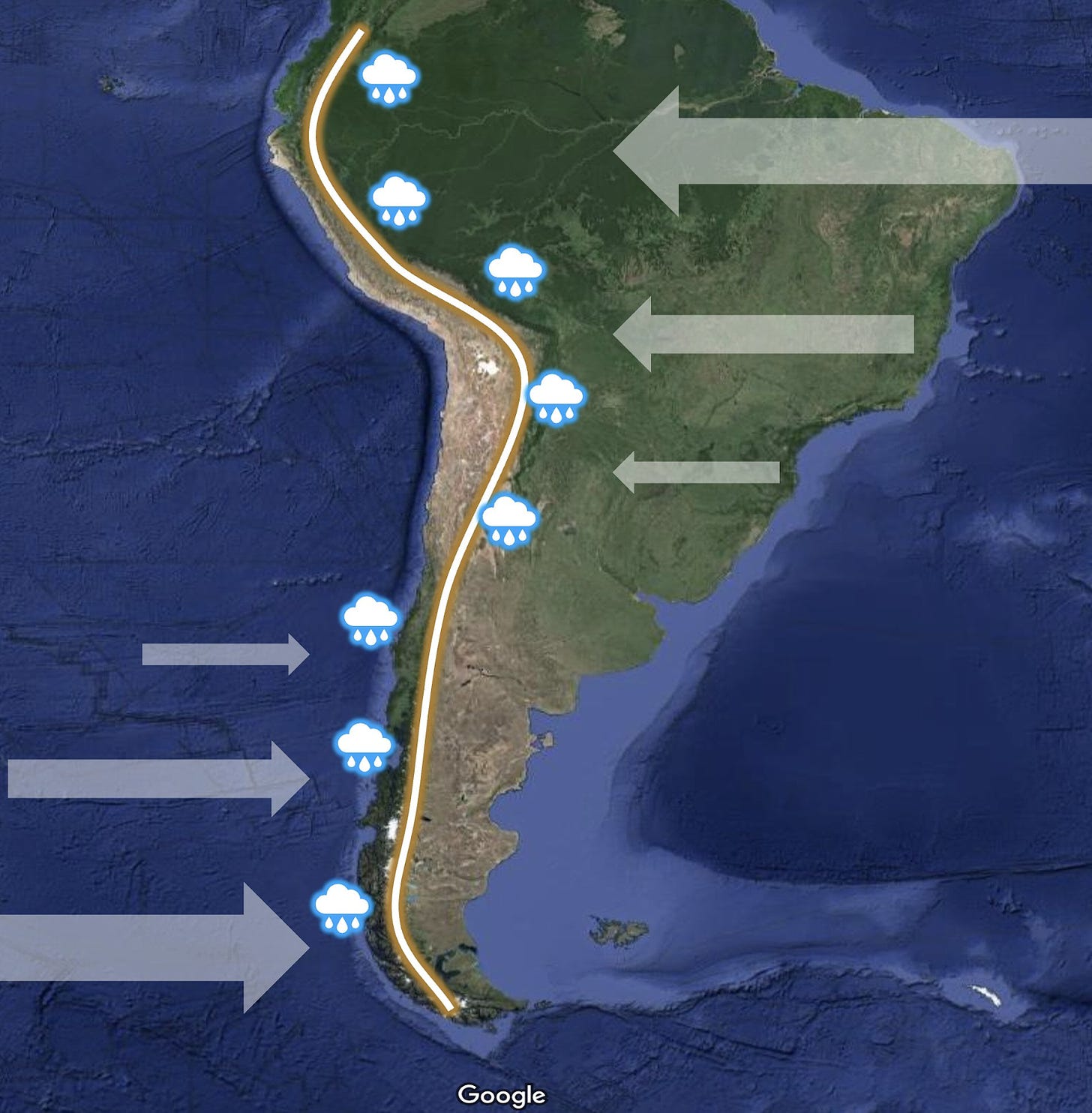
What’s happening?
Winds blow westward close to the Equator and eastward farther south.
The Andes stop all the moisture from the Atlantic near the Equator, and from the Pacific farther south.
That’s why both Brazil and Chile have rainforests.
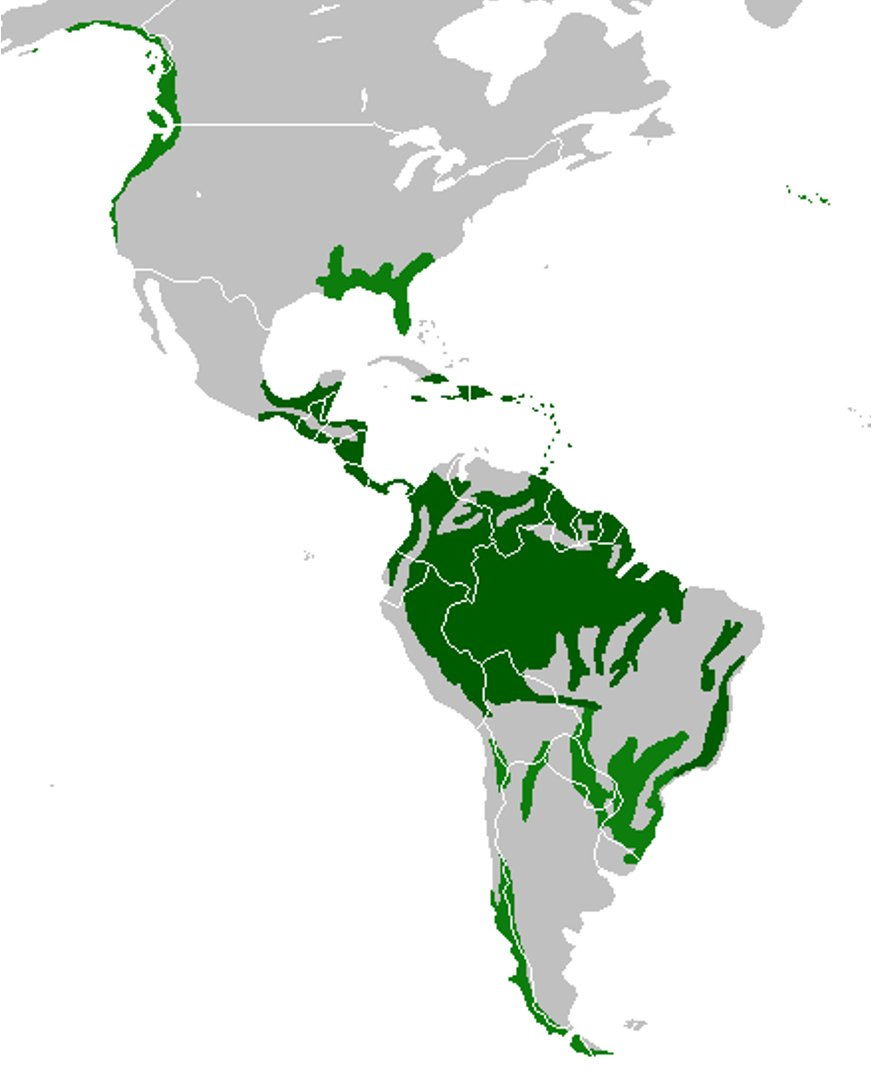
The Chilean one is a temperate rainforest—like in the Pacific Northwest in North America.
You can see that reflected in the map of South America’s forests:
So all of southern Chile is green, but only the northern half of that is warm enough for comfortable living (and close to other countries’ centers of population). That’s where most Chileans live.
What about the northern part then, the desert?
That area is so dry, it can’t support a large population.
And since it’s close to the center of South America, it has neighbors…
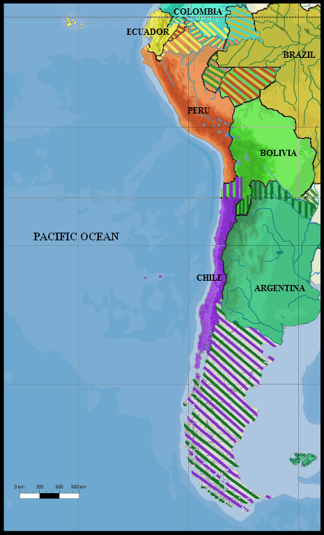
Few locals and lots of neighbors means this area was contested for a long time after the Spanish Empire collapsed.
This is a map of contested areas in South America, 1879:
Peru & Bolivia went to war with Chile for that region, but they lost in the War of the Pacific.
Why fight? Natural resources: guano and saltpeter.
Back then, guano was the world’s main fertilizer (and this area had most of the world’s guano, thanks to the climate).
Saltpeter was useful for gunpowder.
So why is Chile so long, but not longer?
-
A sliver between coast & Andes
-
Far south: too cold for another country
-
Far north: competing neighbors
-
Natural border there: desert. Chile won the war to get the tip.
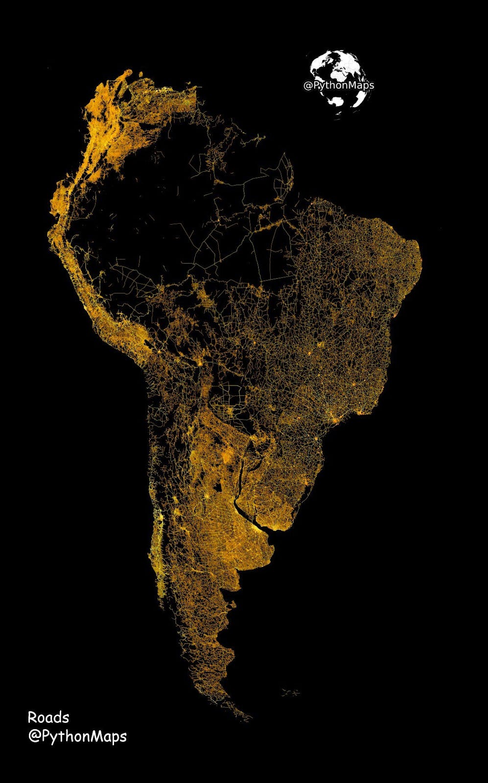
That’s also why most Chileans live in the middle of the country: too cold in the south, too hot and dry in the north.
You can see that effect in a map of South American roads:
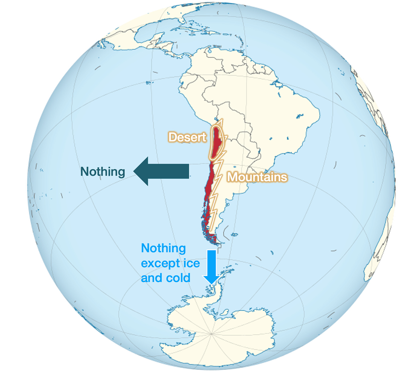
Cold, heat, sea and mountains make Chile a country—an extremely isolated one:
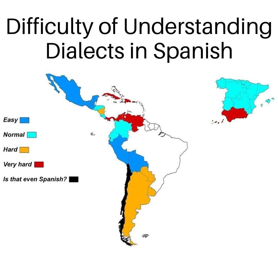
And that’s also the main reason why Chileans are incomprehensible: So isolated from all other Spanish speakers!
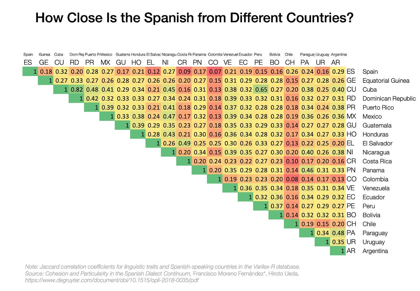
Here’s some more detail, from Why Do 900 Million People Speak Spanish and Portuguese the Way They Do?:
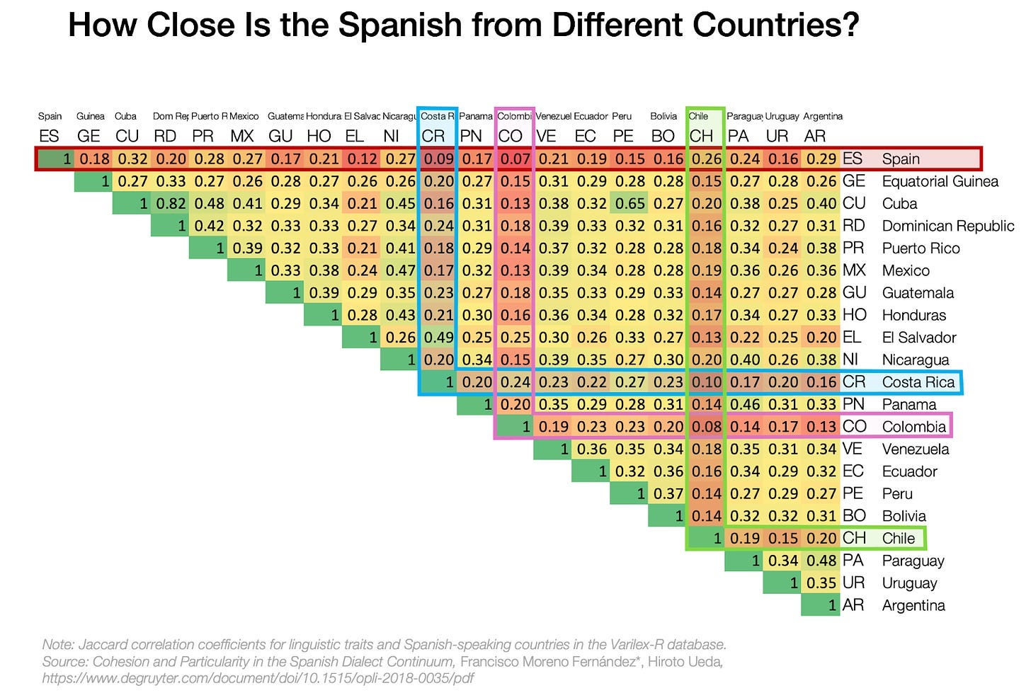
This graph shows how much the Spanish from different countries resemble each other. The greener, the closer. The redder, the farther apart.
You can see some countries are very red:
You see how red Chilean Spanish is? It means it’s quite different. In the beginning of Grad School, I could understand all my Hispanic classmates, but I had a hard time understanding the Chileans!
I couldn’t find any great analysis on this, so if you find it, please let me know. The best hypotheses I could find were:
-
It’s the farthest region from Spain, so the least communicated to the rest of the empire, and hence the one that drifted the most from the homeland.
-
It’s extremely isolated by the Andes, the ocean in the west, the ice in the south, and the desert in the north, making its connection even to Argentina, Bolivia or Peru really hard.
-
It didn’t have silver mines, or a climate for sugar or tobacco farming, so it wasn’t a particularly valuable place to exploit, and remained secondary in the empire, getting fewer visitors from other parts of the empire, and drifting further apart.
-
It has strong influences from other regions, such as German, Italian, or even Basque.
But why is no other country as long?
You need:
-
A sandwich between sea and continent
-
Oriented north-south, so that it changes climates quickly
-
Far enough from the equator so that the north-south climate does change fast, and so that it’s not too densely populated.
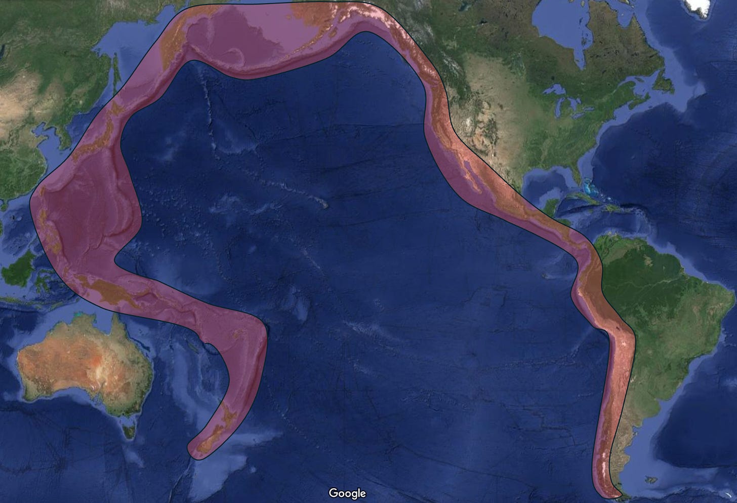
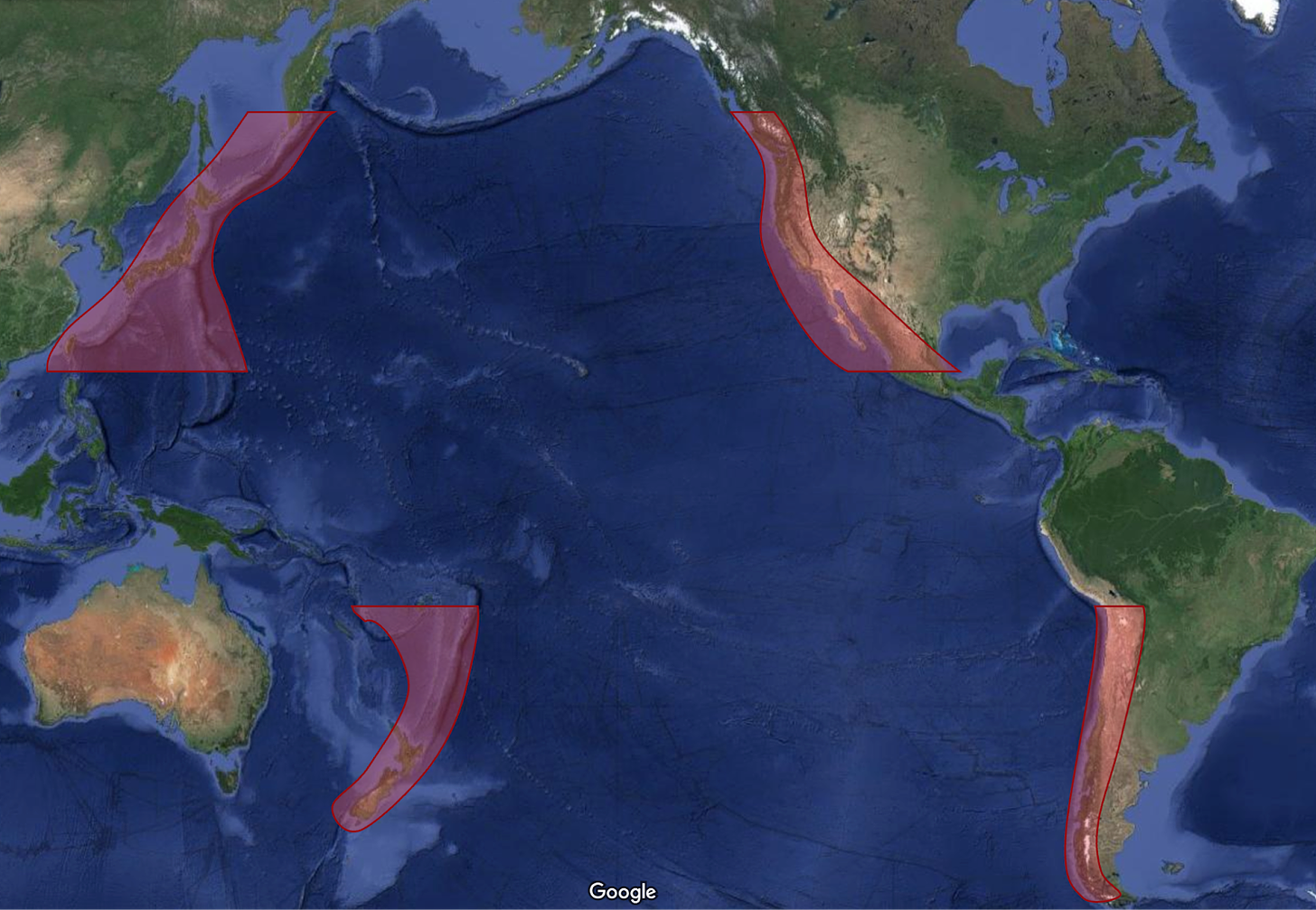
The sandwich requires an oceanic plate subducting under a continental plate, which only happens here:
From there, take out the areas that are equatorial or too cold:
In the western Pacific, that leaves islands, mainly Japan, New Zealand, and maybe the Philippines. But in this part of the world, the mountain chains start from deep under the sea, which generates archipelagos rather than a continental sliver.
In the eastern Pacific, it leaves Chile and the US – Mexico – Canada west coast. An elevation map shows how a country could have been viable here:
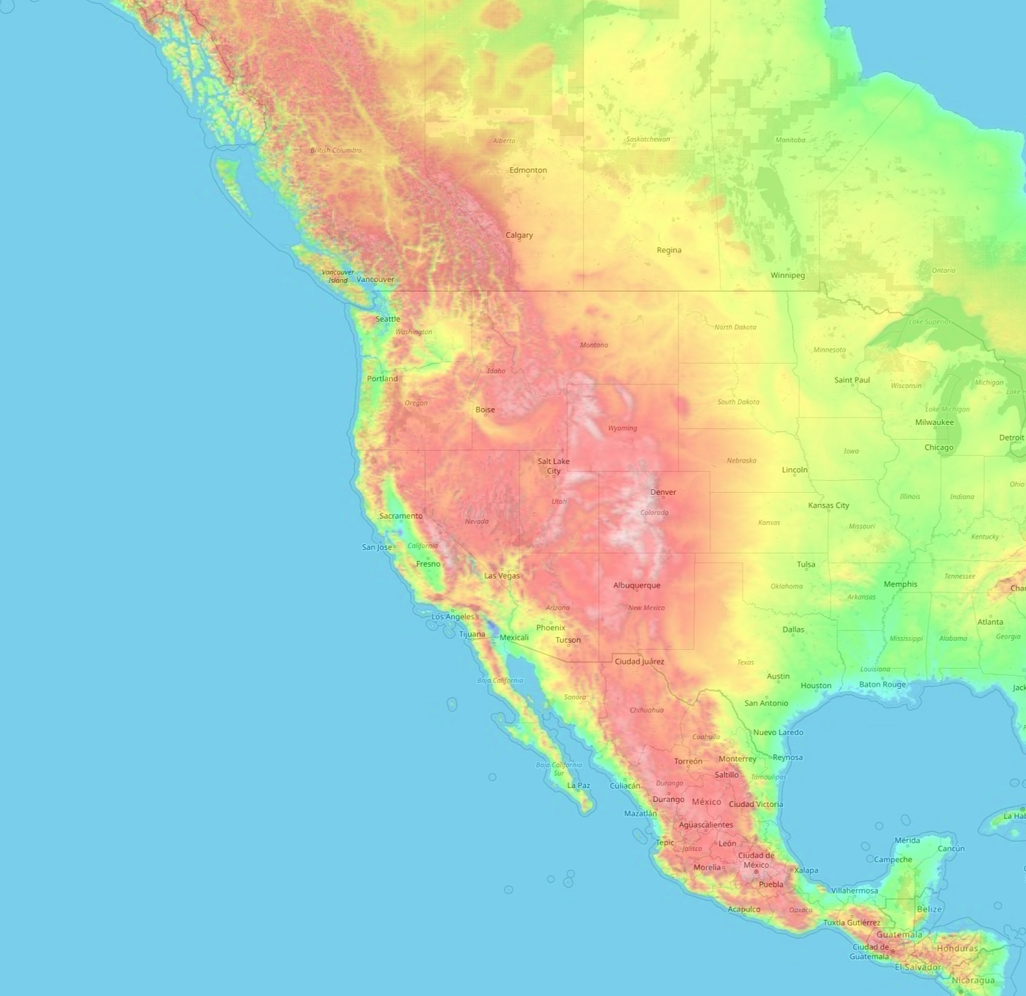
So why don’t we have a Chile of the north?
Mexico was close to Spain, had silver mines interesting to Spain, smaller mountains than the Andes, and is much narrower from sea to sea. All of this made the country much better communicated east-west, so the western coast couldn’t evolve as a separate entity.
In the US and Canadian coast, the US conquered that area from the east extremely fast, making the independence of the West Coast impossible. We can imagine that, if these regions had been left to continue developing for a few thousand years, a distinct country (or set of countries) would have emerged in the west.
So that’s why Chile is one of the longest—and the thinnest—countries in the world!


![Los Angeles DA George Gascon suspends prosecutor for ‘misgendering’ and ‘deadnaming’ trans child molester accused of murder [warning: autoplay video]…](https://salvationprosperity.net/wp-content/uploads/2023/03/los-angeles-da-george-gascon-suspends-prosecutor-for-misgendering-and-deadnaming-trans-child-molester-accused-of-murder-warning-autoplay-video-327x219.jpg)
