In August 2008, the Koshi River—typically meandering from the Himalayan foothills of Nepal down into the plain of the Ganges, waxing and waning with the yearly monsoon—abruptly shifted some 75 miles eastward. The river broke its banks and inundated hundreds of villages in Nepal and the Indian state of Bihar. A million people had to evacuate their homes.
That part of the world is hardly unfamiliar with intense floods, but what happened in 2008 wasn’t just any flood. Rivers don’t often change courses with reckless abandon. But when they do, scientists who study rivers use a special term: an avulsion. Avulsions are rare, but as the Koshi River disaster showed, the consequences can be catastrophic.
Now, scientists have carried out an unprecedented global survey into where avulsions happen, published in Science on May 27. In doing so, they’ve found how avulsions can affect even places that aren’t expecting them.
“Our study is the first global-scale study to map out avulsions at this scale,” says Vamsi Ganti, a terrestrial scientist at the University of California Santa Barbara, and one of the authors.
Previously, scientists focused on individual avulsion cases, in places such as the Mississippi River Delta or China’s Yellow River, a particularly avulsion-prone water channel that’s changed course more than two dozen times in recorded history. The floods from those events have been linked to political turmoil and civil wars, such as an 1850s flood that helped spark the Taiping Rebellion.
Indeed, there’s good reason to study avulsions. They leave behind fertile land in floodplains and help build diverse ecosystems in river deltas. But at the same time, their floods can devastate nearby human settlements. Archaeologists have linked avulsions to disasters as old as ancient Mesopotamian catastrophes.
[Related: Most large rivers don’t flow freely anymore]
Despite this, scientists haven’t really had a great grasp on what causes avulsions. They knew that avulsions tend to happen on rivers that carry large amounts of sediment. (The Yellow River, to wit, gets its name from the amount of silt it picks up.) As that sediment builds up in the river’s path, it’s easier for the river to switch to another nearby course. Over time, the process repeats at the new course, leading to rivers that switch back and forth over the centuries.
It’s fortunate, then, that Ganti, postdoc Sam Brooke, and their colleagues had a surprise tool: satellite imagery. Working with decades of satellite observations, the researchers assembled an avulsion scrapbook dating back to 1973—113 avulsions in all. Most of them happened in the world’s tropics.
“This is a global analysis of avulsions which provides unprecedented information on this process,” says Paola Passalacqua, a water resources engineer at the University of Texas at Austin who was not an author on the paper.
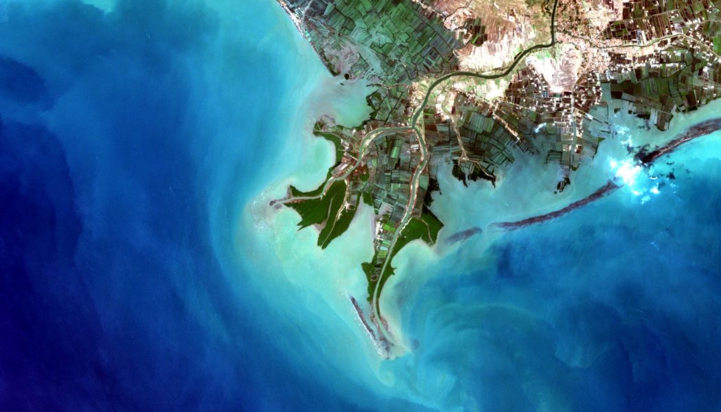
The research team divided that list of avulsions in two categories, based on the sorts of places where they occur. The first are avulsions in alluvial fans, where flowing water, well, fans out: say, exiting a mountain valley or a canyon into a wide-open plain. The 2008 Koshi River flood was one such avulsion. The second category are avulsions in river deltas, where rivers spread their waters into many tinier streams as they enter a water body or a desert.

All of that was known beforehand. But the researchers observed another process at play: In deltas, they found quite a few avulsions happened further upstream than previously thought. They think these avulsions are due to floods. When rivers break their banks, they erode the surrounding land. With enough flooding and enough edits to the landscape, the river may abruptly chart a new, more favorable path.
The researchers think this kind of avulsion is more common on steeper rivers in deserts or in the tropics. And the floods that cause them are predicted to grow more common in a warming world.
[Related: From pollution to dams: here’s what is plaguing America’s 10 most endangered rivers]
“Knowing where [avulsions] might happen is a big help,” says Passalacqua, “particularly if upstream communities may not have expected it otherwise.”
This means better ways of managing waterways. Humans, understandably, don’t like their rivers to behave in unpredictable ways. To prevent avulsions, we’ve tried to manage their flow, corralling them with dikes, levees, and dams. These efforts aren’t new; ancient engineers were trying to control rivers in Egypt, South Asia, and China at least 3000 years ago.
Sometimes it works. Management on the Mississippi River has, so far, prevented a potentially devastating avulsion into the nearby Atchafalaya River in Louisiana. But measures to stop avulsions can be double-edged swords. Along with upstream dams, they can prevent rivers from depositing much-needed sediment in river deltas, undermining their stability.
Meanwhile, rising sea levels are pushing at deltas from the other side. The result of all these processes is that the pressure on rivers—and the risk of avulsions farther upriver—is mounting.
“It seems like all the knobs you can turn on a river delta, you’re turning them in the wrong direction,” says Ganti.
Ganti hopes he and his colleagues’ research can help find ways that let rivers flow naturally and simultaneously protect the more than 300 million humans who live on river deltas. Their next step, now that they know where avulsions happen, is to focus on when they happen. Ganti says that avulsions seem to follow a periodic pattern, repeating every so often. Many of the forces that drive rivers are still poorly understood by experts, even though rivers have helped sustain people since the earliest civilizations.
“There’s a dual nature to our linkage with rivers,” Ganti says, “because they are a nourishing force, but also, they can be a destructive force.”
Join Our Telegram Group : Salvation & Prosperity


