Note from the Author: Copy/paste GPS Coordinates listed below into Google Maps to see or travel to each location.
Since returning back from an overseas assignment in July of 2012, I’ve immersed myself in research about the sites where Jesus lived and performed His mighty works. I’ve been fascinated with being able to see the places in the Gospels where our God made flesh walked and redeemed our world. As I did more research, I learned of many sites I hadn’t heard of before and that are not very well-known. Over ten years since I last visited, I had the opportunity to go back to Israel and visit many of these and other incredible sites I had not seen before. Many of these sites are not normally found on travel itineraries for the Holy Land, but are nonetheless significant.
My wife very generously allowed me to go on this trip while she watched our kids–she is a living saint and very generous to me. For this trip, I wanted to travel quickly and for long hours to fill my days with as many sights as I could; I mostly lived off of beef jerky, trail mix, and bagels with peanut butter over my five days in Israel. By traveling solo on this trip, it also was like a “silent retreat” for me–at the very places I could read about in the Gospels! I was joyful for this opportunity, but being away from my wife and kids and the ever-present unknown of what challenges could await me on a pilgrimage are always sources of anxiety, but opportunities to trust in God’s providence. For this trip in particular, which originated at my current home in Germany, this anxiety gave me a miniscule taste of what it must have felt like for the many pilgrims throughout history who left families and homes, and traveled the great distance from Central Europe to the Holy Land. Except, my “journey” there in the 21st Century would only take 5 hours by air and I would be traveling into a friendly nation–these circumstances are a huge blessing that countless other pilgrims in centuries past were not so lucky to share. Pilgrims traveling from Central Europe in centuries past–on fire with the desire to see the places where our God and Master actually walked the earth in human form–traveled, many by foot, at least 2,400 miles over months (for some, it took YEARS). They boldly, step by step, trekked through lands where terrible sicknesses were pervasive without modern medicine, the elements and terrain were harsh, hunger was a part of life, and death by the sword was a distinct possibility. The conditions of the past are a stark contrast to the blessings of modern travel we enjoy today; and yet, millions were inspired on a visceral level to risk *everything* for love of Christ. If only I could share in but a sliver of that love and devotion!
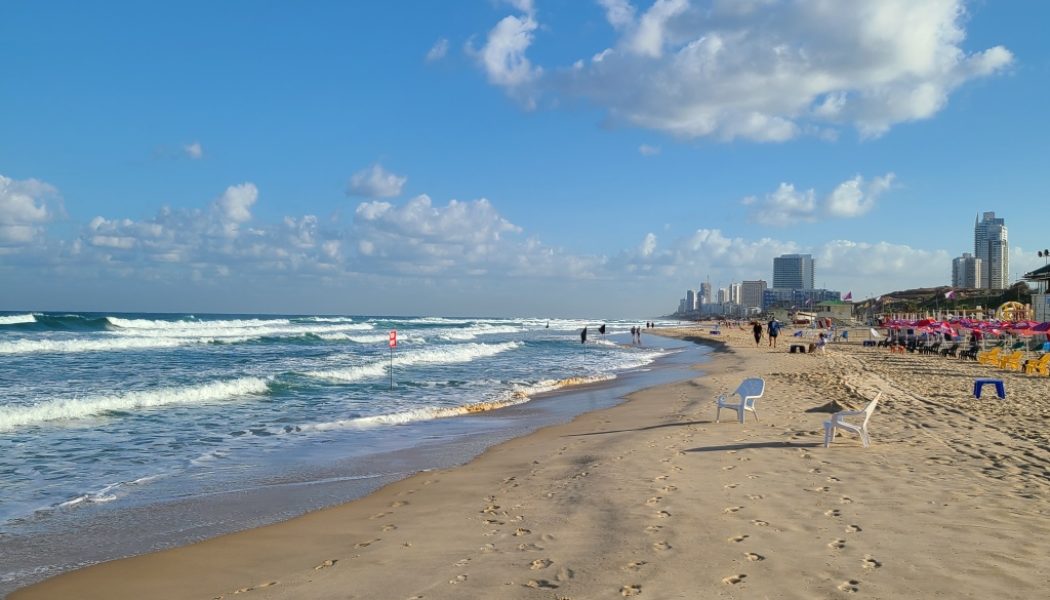
After my wife dropped me off at our local airport in Germany, I took a night flight through Warsaw, Poland that arrived at Tel Aviv Airport at 3:35 in the morning. After picking up my rental car, resting for awhile (but I was too excited to sleep!) in my car in the car rental parking lot since I didn’t get much sleep the night before, I set off to the first stop of many on my pilgrimage: Tall Yunis–the beach where ancient tradition holds the Prophet Jonah was spat back up by the whale (GPS Coordinates: 31°59’47.74″N, 34°43’50.62″E). Overlooking this beach on Israel’s coast of the Mediterranean Sea is Tel Yonah, a small hill that once had a Byzantine Church dedicated to Jonah to commemorate his presence there (GPS Coordinates: 31°59’46.15″N, 34°43’57.04″E).


It was incredible to walk along the beach where Jonah may have been (the hill of Tel Yonah itself is unfortunately inside the perimeter of an Israeli military base, and I couldn’t climb it). After reading the story of Jonah and the whale from the Bible on my phone, I looked up the beach at the hill landward. I meditated on what Jonah must have felt and thought as he looked at this same place after being dead in the belly of a whale for 3 days and being brought back to life like our Lord–the “Sign of Jonah” Jesus mentions in the Gospel. He had to have known so clearly there was no more running from God’s will and that he needed to begin his mission right away–and there was much work to do. After being dead for 3 days and being spat up on this beach, Jonah would then need to walk 568 miles as the crow flies to ancient Ninevah, in modern Mosul, Iraq, and then convince the entire great city of Nineveh to repent. His decision to take those first steps up that beach must have been very solemn–the first steps on a long journey and the first forward movement to conquering a daunting challenge he had just (unsuccessfully) run from. As we all know, he would complete his journey and inspire the pagans of Nineveh to repent in sack cloth and ashes, just as the Christian faith would miraculously convert Rome after Jesus was brought back to life after 3 days. By cooperating with God’s will, God’s grace empowered Jonah–and the first Christians–to achieve the impossible.
After visiting this beach, I drove up Israel’s Mediterranean coastline to my next destination: The Battlefield of Arsuf (GPS Coordinates: 32°12’2.83″N, 34°48’57.79″E). This site was the location of a titanic battle during the Third Crusade in 1191. After capturing the city of Haifa from a garrison of Ayuubid Muslims, King Richard I of England (known also as “the Lionhearted” for his ferociousness in combat and dedication to duty) made the risky decision to move his army further south down the coast despite the legendary Muslim caliph and general, Saladin, having his exceptional army just to his east. Richard must have known that any large-scale movement of his army would have invited a determined attack from the Muslims defending the Holy Land, which they had largely taken back from the Christians just a few years before. Richard chose to move south with the right flank of his column of Crusaders flush with the Mediterranean coastline (thereby eliminating any chance of Muslim envelopment of his army from front and rear) and he put his heavy cavalry in the center of his column protected by infantry to the front, left and rear. As the Crusader army moved south towards its objective, the city of Joffa (modern Jaffa), Saladin moved alongside the column at a distance.

From Wikipedia
Eventually, Saladin ascertained Richard’s objective, and he took the bait by ordering an attack on the columns of infantry. After getting drawn into a pitched battle with the Crusader infantry, the Muslim Army began to overextend themselves and the Crusaders seized upon this opportunity to launch a blistering heavy cavalry charge into Saladin’s army near the town of Arsuf. The charge repelled Saladin’s attack and forced the Muslims to retreat. It was a great victory for the Crusaders.
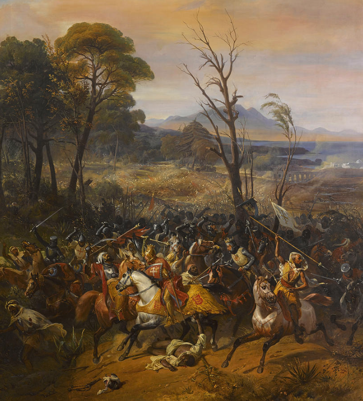
The site of the battle today, confirmed by archaeological discoveries in the 2010s (see research by professor Rafael Y. Lewis of Ashkelon Academic College, Israel) of Crusader-era arrowheads and a horse bridle, is desolate and covered by spiky overgrowth, and is actually now south of the modern town of Arsuf–the town which migrated north from its medieval location over the centuries. It was amazing to me this massive battle occurred at, what is today, such a non-descript place with no signs or other markers indicating this was the site of the battle. It’s also not as picturesque as in the painting above…haha.


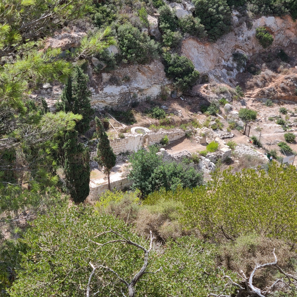
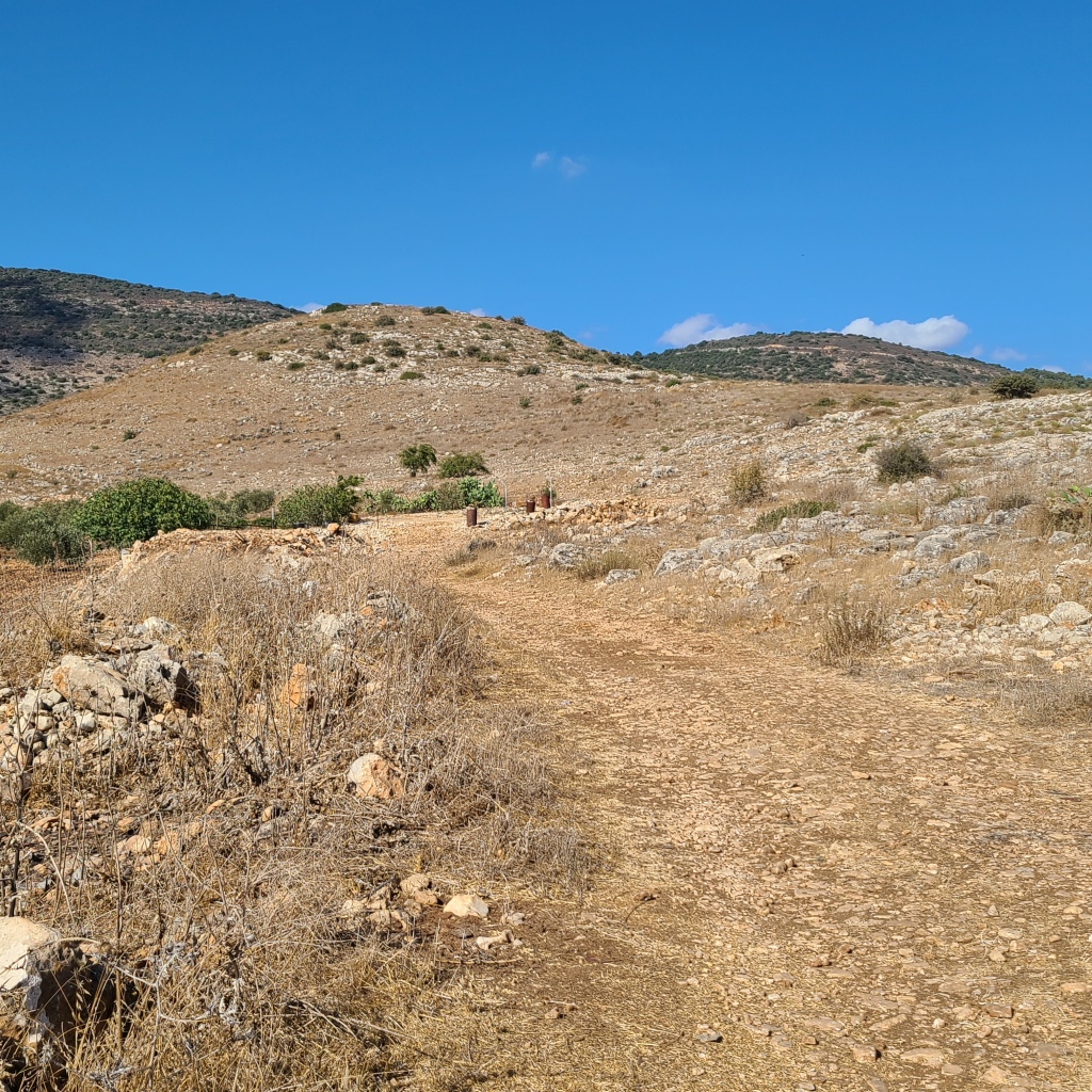
After reading an account of the battle at the battlefield itself, I continued to drive north along Israel’s coast through several large, bustling cities to the city of Haifa and to Mount Carmel. Mount Carmel is known for being the place where the Prophet Elijah lived contemplatively in a cave and where, with God’s help, triumphed over the pagan prophets of the god Baal. During the time of the Crusades, monks who had traveled to the Holy Land on pilgrimage sought to imitate the spirituality of Elijah and also began to live in caves on Mount Carmel. A priest by the name Brocard built a church adjacent to some of these caves and became one of the founders of the Carmelite Order of religious monks and nuns (which takes its name from Mount Carmel). Many famous Saints since joined this order, which now exists throughout the world, to include: St. Teresa of Avila, St. John of the Cross, St. Teresa Benedicta of the Cross (Edith Stein), and St. Thérèse of Lisieux. I paid a visit to the remains of the first Carmelite church, known as the Church of St. Brocard (GPS Coordinates: 32°48’3.34″N, 34°58’24.31″E), tucked into a deep fold of Mount Carmel. The church was in ruins but, nonetheless, impressive. It was fascinating being at the place where such a consequential religious order traces its beginnings. I tried to imagine the first Carmelite monks who had once stood within these very walls 800 years ago chanting God’s praises, praying, and celebrating the Holy Eucharist.


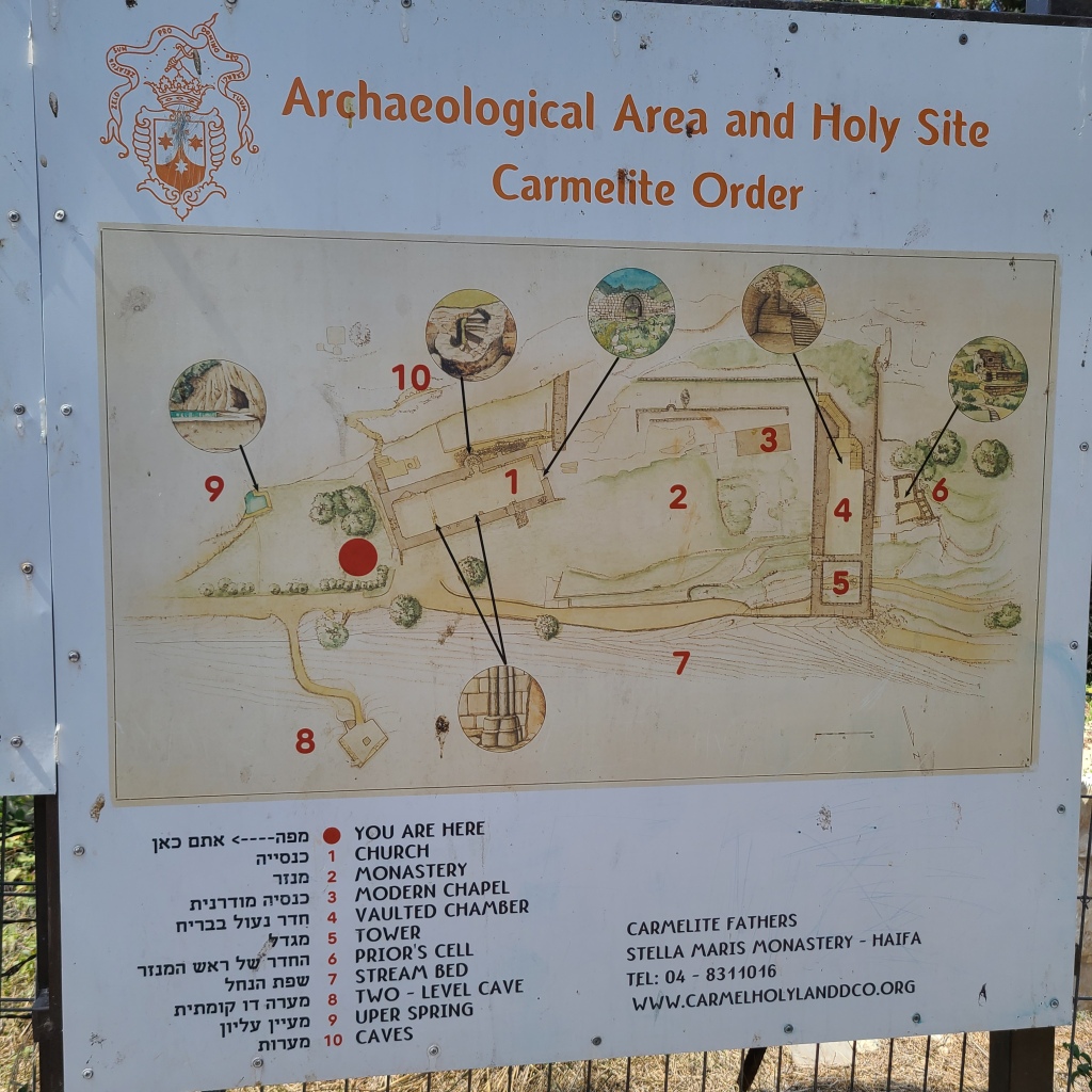
Yet another spectacular part of my visit to this place was seeing the ancient caves–still intact (see photos below)–which had served as the Carmelites’ cells for prayer, in imitation of their order’s great exemplar, Elijah. I meditated on what life must have been like for these monks–what it must have been like to pray constantly day and night in these white, chalky caves for the salvation of souls. I am convinced that if it were not for the prayers of religious orders throughout history–God’s “Special Forces” as I like to call them–humanity would have destroyed itself long ago.


I asked St. Therese and St. Teresa of Avila to pray for my intentions, climbed back up the side of the valley, and drove off to my next destination.
The next stop on my trip was to do my own survey of an alternative location of the town of Cana mentioned in St. John’s Gospel where Jesus turned water into wine. The name of the former 1st Century town which stood here is “Khirbet Qana.” The remains of this town are situated on a rocky, cave-riddled outcropping from a mountain range along the lovely Beit Netofa Valley. The traditional location of Biblical Cana is the modern town of Kaffar Kanna. However, because Khirbet Qana’s name contains a word that sounds like “Cana,” and because of the discovery of a certain cave complex at Khirbet Qana that was venerated by Byzantine Christians, it is thought by some that this place could be the actual Biblical Cana.
This place was a little difficult to get to. Google Maps sent me on a wild goose chase through some fields and I ended up re-routing myself to enter the city of Kafr Manda from the west, I then drove east through this city, and then was able to keep driving east to the site of Khirbet Qana with little trouble. I parked my car (here at GPS Coordinates: 32°49’11.15″N, 35°18’4.13″E) and started climbing the hill of Khirbet Qana.
The view was amazing…
Shards of pottery (a common indication that a place was inhabited in ancient times) were scattered all over the outcropping. One of them I saw even still had green paint/glaze still on it! (see below)

In 2015 it was announced a group of archaeologists led by Dr. Thomas McCollough of Centre College in Danville, Kentucky were studying the ancient town’s archaeological remains and discovered a system of caves which had indications of being venerated in Byzantine Period (estimated at A.D. 415-654). An altar with 2 stone jars, a cross carved into the altar stone, numerous small niches for candles, and the remains of golden liturgical items were some of the indicators discovered.
Although I knew the cave was on the outcropping, I didn’t at first know which cave was the venerated cave studied by the archaeologists…and there were A LOT of caves. I had plans to do a lot of different activities on my pilgrimage, but spelunking was not originally one of them! But, that’s what I did…I explored 5 or 6 different caves until I was finally able to locate the venerated cave (below) (GPS Coordinates: 32°49’19.20″N, 35°18’12.07″E).


Unfortunately, it looked like the cave had been tampered with since the archaeologists were there, but I was still able to get a sense of how the cave was laid out based on a description and pictures of the cave from the November/December 2015 issue of Biblical Archaeology Review.

It was a pretty amazing place and I even saw some pilgrim graffiti in Greek written on one of the walls of the cave (below).

There was a lot of work that still needed to be done inside the venerated cave system–the caves were filled with loose dirt, almost to the ceilings of some of the caves, that had filled them over the centuries. It was interesting to envision these caves as rooms of an ancient house and potentially rooms of a monastery complex where Masses were said by clergy of the past.

Although this could have been the site of Cana from the Gospel of John, even after my in-person survey, I still believe the actual site of the Cana mentioned by St. John is today’s modern Kaffar Kanna. In this town, a church stands over the remains of an early structure. Of this structure, archaeologist Dr. Dennys Pringle says in Volume 1 of his preeminent series The Churches of the Crusader Kingdom of Jerusalem: “It seems very probable that [this early building] was in origin a synagogue of the third or fourth century AD.” There is archaeological evidence to believe this site is linked to an early Christian known as “Count Joseph” of Tiberias who, on commission from the Emperor Constantine, built churches throughout towns in Galilee. For this and other reasons I record in more detail in my book, The Second Person of the Trinity in Time and Space (see the end of this article for more information about it), I believe the Wedding Feast of Cana happened at Kaffar Kanna, not in the cave at Khirbet Qana. It was in the church in Kaffar Kanna (GPS Coordinates: 32°44’49.22″N, 35°20’19.02″E) where my wife and I renewed our wedding vows in 2011 as pictured below.


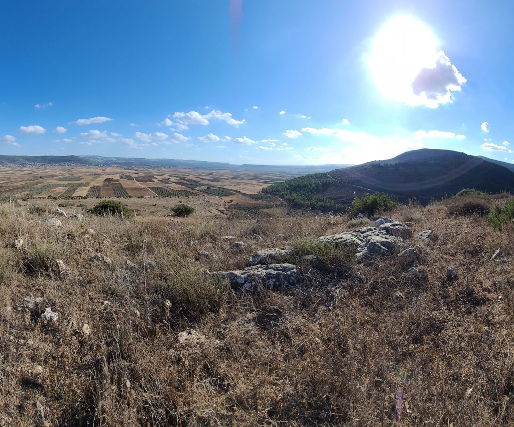
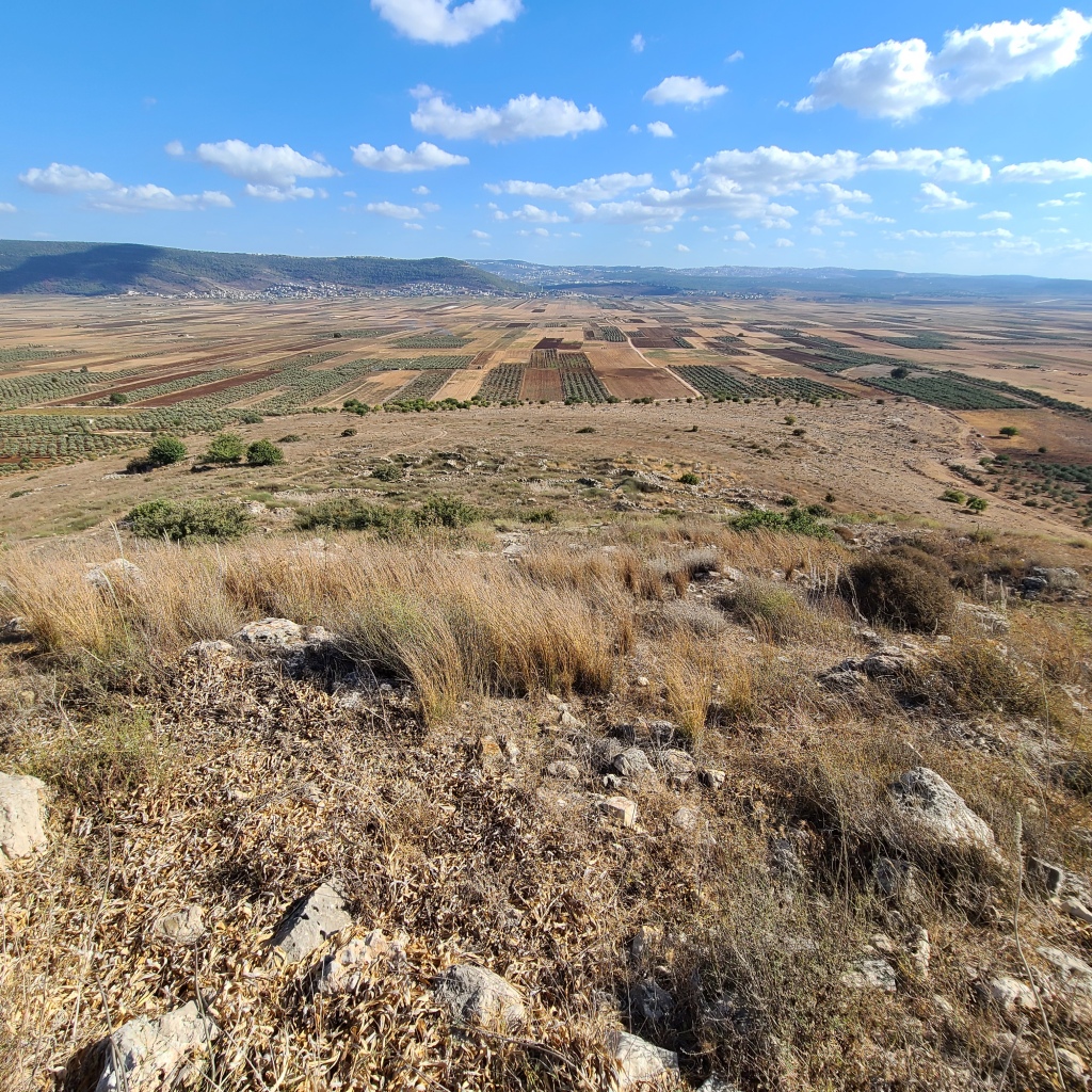
After my spelunking adventure at Khirbet Qana, I drove over some very rocky road to my last stop of the day: the Battlefield of Hattin (GPS Coordinates: 32°47’53.51″N, 35°27’26.66″E). At this battlefield are the famous “Horns of Hattin”–the remains of an extinct volcano that collapsed inward, creating two rocky peaks which look like horns protruding from the arid Galilean landscape (GPS Coordinates: 32°47’56.67″N, 35°27’32.04″E). It was here in the searing heat on July 4, 1187 one of the defining battles of all history took place between the forces of the Crusader Kingdom of Jerusalem and Muslim forces under the command of their sultan, Saladin. In the early Summer of 1187, Saladin made the decision to invade the Holy Land with an army of 20,000 troops and began his campaign by laying siege to the city of Tiberias on the west coast of the Sea of Galilee. The king of the Crusader Kingdom of Jerusalem, Guy de Lusignan, decided to muster crusader forces from across the Holy Land to meet this threat, assembling a force of 1,200 knights and 18,000 infantry. As this force marched to an assembly area in the town of Sephoris (modern Tzippori, Israel) in late June, it quickly became apparent that the availability of water for so many men was going to be a major problem. King Guy decided to march his army 11 miles east towards the town of Hattin where the only spring of water along their line of march to Tiberias existed. When Saladin heard of the Crusader advance, he dispatched light cavalry to harass the crusader army and slow their advance–the longer he could slow their advance, the weaker the Crusader army would become for lack of water. Eventually the Crusader army would make a last-ditch effort to break the Muslim encirclement near the Horns of Hattin, but the Crusader host then became divided and surrounded, leaving them the choice to either surrender or die. King Guy would be captured and his army defeated at Hattin–a seismic turn of events that still reverberates through history. With the army of the Crusader Kingdom of Jerusalem all but annihilated, the Holy City, having been in Christian hands since the First Crusade in 1099, would fall into Muslim control just three months after this battle. Holy Roman Emperor Frederick II, who led the Sixth Crusade, would negotiate the city’s return into Christian hands in 1229, but it would be recaptured by Muslims once again in 1244. It would not be under Christian control again until British troops captured the city from the Ottoman Empire in 1917 during World War I.


I drove along the line of advance of the crusader army up to the foot of the horns where the crusaders made their final stand. I was the only person there. As the sun went down in the west, it was haunting to imagine the carnage which took place here. I tried to imagine what it must have been like to be a crusader infantryman:
Clad in heavy armor/chainmail and a hot woolen tunic in the baking sun. Choking mad with thirst. Exhausted after a sleepless night having arrows shot into your camp by the enemy surrounding you. Smelling mud made from human blood. Feeling dizzy and weak. Having a feeling of no escape and knowing death from battle, or execution by your enemies could very shortly be your fate. Wishing with all your being you could make it to the town of Hattin on the other side of those desolate hills for a sip of water or, even better, to the bounteous, sweet waters of the Sea of Galilee just 3.7 miles further east.


After parking, I climbed up the north peak of the Horns of Hattin. The view was absolutely breathtaking. Not only was it naturally beautiful, it was incredible seeing the entire battlefield laid out before my eyes. I tried to envision lines and columns of thousands of men and horses colliding in the plain below, fighting to the death for their religion and for survival. This was the site of a battle that would change the history of the world forever.


After spending some time in silent thought at the Battlefield of Hattin, I got into my car and drove four miles east to the city of Tiberias. I checked into my hotel, ate a delicious dinner of beef jerky and peanut butter & honey bagels, and fell fast asleep. I was excited for my next day of adventures following in the footsteps of Christ at some little-known Holy Sites in the region of Galilee.
Stay tuned for my post next week as I travel to more sites including the site of Jesus’s healing of the hemorrhaging woman, the Sea of Galilee, the town of Daburiyya which tradition designates as the place where Jesus may have healed a demonic boy after the Transfiguration, and little-known sites in the town of Nazareth. Thanks for reading and see you next week!
If you enjoyed, this post, check out my one-of-a-kind book, The Second Person of the Trinity in Time and Space: What is Known Historically About Jesus and the Holy Sites of the New Testament, sold on Amazon.com! (see below)
.wordads-ad-wrapper {display:none;font: normal 11px Arial, sans-serif;letter-spacing: 1px;text-decoration: none;width: 100%;margin: 25px auto;padding: 0;}.wordads-ad-title {margin-bottom: 5px;}.wordads-ad-controls {margin-top: 5px;text-align: right;}.wordads-ad-controls span {cursor: pointer;}.wordads-ad {width: fit-content;margin: 0 auto;}