Note from the Author: Copy/paste GPS Coordinates listed below into Google Maps to see or travel to each location.
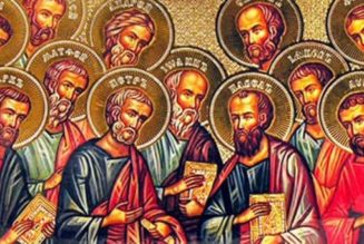
When I was stationed in Turkey, I had the opportunity to travel much of the country, however, the massive Anatolian Plateau in Central Turkey–comprised of the ancient provinces of Galatia, Phrygia, Pisidia, Lower Armenia, and Pontus–alluded me. Once I returned home from Turkey, I did a lot more research about the holy heroes of our faith who traversed Turkey’s “Great Plains” in ancient times and where they went. After 10 years, I was able to journey back to Turkey to follow in the footsteps of some of the Church’s greatest Saints: St. Paul the Apostle and St. Barnabas, St. Timothy, St. Basil the Great, St. Gregory of Nazianzus, St. Blaise, and St. John Chrysostom. I was also exceedingly blessed to have a good friend of my wife and me, Father J., as my wingman for this trip. It was awesome to have someone (a Catholic priest, no less!) there to keep me company, to watch my back, and to sanctify this pilgrimage through his presence and the exercise of his ministry as a priest.
We landed in the city of Ankara, Turkey’s capital city, late in the evening and started our long but exciting journey the next day. It was a beautiful day outside, and the sun lit up the very large hills that were scattered throughout the Galatian landscape. The ancient province where Ankara is located is Galatia. It was the people living in this territory who St. Paul addressed his “Letter to the Galatians.”
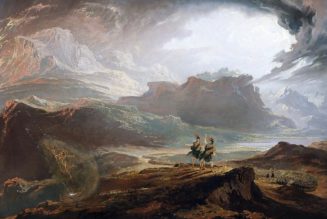
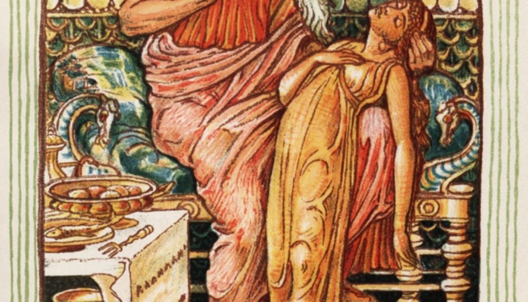
Our first stop on our trip was actually not a Christian site but a famous place from antiquity, which was a silent witness to historic events and the lives of extraordinary people. This place is the ancient city of Gordion. It was the home city of King Midas of the “golden touch” (who was actually an historical figure) and the place where the famous Greek conqueror Alexander the Great of Macedon “undid” the fabled Gordian Knot.
The existence of King Midas is attested to in ancient accounts, and he lived in the 700s B.C. There are few scant details in history about him: his marriage to a Greek princess, his trip to Delphi in Greece to sacrifice to the sun god Apollo, and his death during the invasion of his territory by another people. The story of his “golden touch” may have originated due to the great wealth and power he possessed.

Alexander the Great conquered most of the known world from Greece to northern India before his death at age 32 (see map below). During his short life from 356 B.C. to 323 B.C., he never lost a battle.

Alexander desired to conquer the Persian Empire, which had traditionally been a rival of Greek peoples for several hundred years. When he invaded Asia Minor (which had been under Persian control), his conquest brought him to Gordion in 333 B.C.
Inside Gordion’s acropolis stood a farming yoke tied to the pole of a Phrygian wagon. The wagon was associated with Gordias, the mythological first king of Gordion, and a relative of King Midas. The wagon was connected with the Gordian dynasty’s rise to power.
Supposedly, the knot tying together the yoke and cart was impossible to untie, and no one had, over centuries, been able to untie it. A local prophecy had decreed that whoever could loosen the knot was destined to become the ruler of Asia.
Alexander decided that he would be the one to achieve this prophecy and earn the title “conqueror of Asia.”
However, rather than even trying to untie the knot through normal means, Alexander thought “outside the box.” Taking his sword, he cut right through the knot, and thereby, technically, “untied” the legendary knot.

Alexander left Gordion thinking he would indeed bring all of Asia under his control. And, within several years, he had conquered Persia, the mightiest empire in the world at the time, and had reached the western fringe of ancient India, seemingly fulfilling that prophecy.
This event is amazingly immortalized in modern language today. According to Merriam-Webster, “Since [the time of Alexander], ‘Gordian knot’ has become a term for a difficult problem, and the phrase ‘cut the Gordian knot’ has become a popular way to describe a neat solution for an apparently insurmountable difficulty.”
When we reached Gordion, we first stopped at an excellent museum near the remains of the ancient city that contained numerous artifacts from the city’s storied past that had been discovered in archaeological excavations. (Gordion Museum GPS Coordinates: 39°39’10.65″N, 31°59’47.62″E)


One of the displays was a reconstructed mosaic floor that had been discovered in the ruins of the city’s citadel. The museum claims this is the oldest colored stone mosaic in the world, dating to the 9th Century B.C.!

They also had some iron tools from Iron Age Gordion (1200 to 550 B.C.).

Some very striking artifacts were a few beautifully preserved blue glass bracelets dating from Roman times or later.

After exploring the museum, we walked across the street to a structure dating back to the time of King Midas himself (700s B.C.): a grand, man-made earthen mound (i.e. a “tumulus”) used as a tomb structure. Some think this tomb may have been made by Midas for his father, Gordias (Gordion’s namesake). (Midas Tumulus GPS Coordinates: 39°39’11.45″N, 31°59’48.20″E)

There was a long subterranean passage that led to the center of the tumulus where Gordias was entombed.

The underground tomb in the center of the tumulus is actually still there and is incredibly well preserved. It is the oldest wooden structure still standing in the world…standing for 2,700 years (see photo below).

After exploring the “Midas Tumulus” we drove about a half mile to the ruins of the ancient city of Gordion (GPS Coordinates: 39°38’59.98″N, 31°58’49.93″E). Below is a map of the ancient city’s walls and buildings from different time periods (as designated by different colors). The citadel area, where the Gordion Knot would have been kept, would have been near the center of the city where construction was most dense.

Below are the remains of the main southern gate of Gordion.

The photo below is inside the gate, looking at the area where the citadel would have stood. It was near this spot where Alexander would have cut the Gordion Knot! In this picture, you can also see the Midas Tumulus (the large light brown hill in the distance about .5 miles away), along with several other smaller Gordian tumuli mounds that also would have contained ancient tombs.

It was an incredible feeling being at a famous location where the great conqueror had made history and created a new idiom that has been used for thousands of years.

After exploring Gordion, we stepped off to our next destination: Antioch in Pisidia, one of St. Paul’s stops during his First Missionary Journey (see map below). It was a three hour drive through beautiful Fall countryside in Turkey. The hills were absolutely beautiful.

We arrived at Antioch in Pisidia (GPS Coordinates of Entrance: 38°18’12.77″N, 31°11’7.31″E) in the early afternoon. It was clear and pleasant outside. The ruins of the city are just outside the modern town of Yalvaç, Turkey. We paid the entry fee to get into the site of the ancient city. The city was magnificent and must have been a hundred times as magnificent in the 1st Century when St. Paul lived and ministered to the fledgling Christian community here.

The site was well-marked by signs with information about different ruined structures in the city. Below is an artist’s rendition of the city plan with its roads and buildings.

We first came to the remains of the ancient gate of the city. It once contained a majestic triple archway that people could walk through. Today, the foundations of the arches and carved panels, which once decorated the gate in Roman times, are all that remain. The paving stones that made up the ancient road leading through the gate had been worn smooth from hundreds of years of foot traffic. St. Paul and his companions had to have come in and out of this very gate many times.


Not far from the main gate, on the edge of the city and far from the pagan temple dedicated to Caesar Augustus, exists the remains of a church very special to the history of Christianity. It was on this site where, according to some archaeological evidence, a synagogue once stood where St. Paul preached to the Jews of the city (see Acts 13:14) (GPS Coordinates: 38°18’23.49″N, 31°11’15.49″E); after being contradicted and reviled by some of the Jews here, St. Paul and St. Barnabas, for the first time, took it upon themselves to preach to the Gentiles (i.e., non-Jews).

The form of this church is actually very interesting. There is an upper level and a lower level. The lower level itself (see picture below, taken from the upper level) was carved into the natural rock of a sloping hill. It makes me wonder if this part of the church was the original location of the synagogue.

As I mentioned earlier, I was INCREDIBLY blessed to have a fantastic friend of my family, Father J., with me on this trip.
While we were there, we were able to celebrate Mass. It was an extraordinary experience, to say the least. Receiving Jesus in the Eucharist where one of the first Christian communities was established by St. Paul and where he first preached to the Gentiles, nonetheless, was incredible.
I reflected on how St. Paul must have sounded when he preached. He had to have had a strong presence that must have captivated his listeners–on fire with the Spirit and given the graces he needed to “turn the world upside down.” (Acts 17:6) That Father and I were there amongst the stones and earth that would have heard his voice was a great blessing. The first reading for that day was even a reading from one of St. Paul’s Epistles.

After Mass, we continued to explore the city. Outside the city walls, you could still see the outline of Antioch in Pisidia’s hippodrome–it’s chariot racing track (GPS Coordinates: 38°18’25.12″N, 31°11’9.18″E). The outline of the spina (the “spine” of the race track in the middle the charioteers would ride around) and the sloped hills where the spectator seating would have been were still discernable.

We also saw the city’s stunning theater (GPS Coordinates: 38°18’17.74″N, 31°11’18.84″E). Tradition has it that the first female Christian Martyr and a disciple of St. Paul, St. Thecla, was fed to lions here. I’ve never heard of people being fed to beasts in a theater complex like this…usually these occur in an amphitheater, which is a circular/oval shape (like the Colosseum in Rome). So, a part of me wonders if St. Thecla may have been fed to lions in the hippodrome instead. To my knowledge, there is no record of an amphitheater in Antioch in Pisidia, and one has not been discovered.

As we climbed up the seating of the theater, you could still see Greek letters, perhaps designating individual seats or vertical rows, carved into the seating. (see the center of the photo below)

After visiting the theater, we kept walking up the hill the city was built on, to the summit. It was here the Romans carved out of the rock of the hill a Temple dedicated to Caesar Augustus (GPS Coordinates: 38°18’14.16″N, 31°11’30.77″E). Given the size of the site and the lack of modern technology/tools, creating the area to build up the temple alone must have required an exceeding large amount of hard, manual labor.

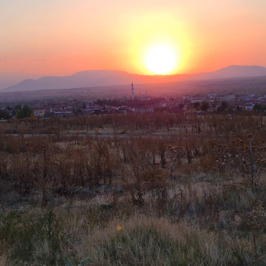
As the sun began to set, the views of the autumn countryside below the hill and around us began to become even more beautiful. Below is an ancient colonnaded street with one of the city’s still-standing aqueducts in the distance.

Sunset over the modern Turkish town of Yalvaç outside of Antioch in Pisidia…
With sunlight slowly fading, we hopped in our car and rode along the route St. Paul took on his First Missionary Journey to our next destination: ancient Iconium, known today as “Konya” (GPS Coordinates: 37°52’20.79″N, 32°29’31.72″E).
As we drove through the hills along our route, I continued to grow more and more impressed with the fire, resiliency, hardiness, and physical strength of the Apostle and his companions. This land was beautiful, but full of hills, woods, and rugged terrain. Traveling this leg alone of just his first missionary journey (95 miles) would not have been for the faint of heart. Paul did it in sandals, braving the elements and disease, and risking attack from bandits, all for Christ and the Church.
I’m not sure if an equivalent study has ever been done on the skeletal remains of St. Paul (please add a comment below if you know of one), but I’ve read that an analysis was completed on the skeletal remains of St. Luke the Evangelist–a companion of St. Paul on some of his journeys. The analysis revealed the man whose bones these were led a very active life with a great amount of walking–his bones had been worn down from all the walking he had done. I can imagine St. Paul’s must be even more so. Thanks be to God for inspiring in St. Paul and his companions such tireless love for humanity.
We arrived in Konya at nighttime and we were surprised at the size of the city, lit up in the dark, as we drove over a ridge overlooking it. We checked into our hotel, and adjacent to the lobby was an impressive modern mosaic of a “Whirling Dervish”–a famous group of Islamic monks who had their origins in Konya. To pray, they spin themselves round and round until they find themselves in some kind of trance. Very interesting.

We went to sleep that evening excited to set out to the next city on St. Paul’s First Missionary Journey: Lystra–the hometown of Paul’s disciple, St. Timothy.
If you enjoyed, this post, check out my one-of-a-kind book, The Second Person of the Trinity in Time and Space: What is Known Historically About Jesus and the Holy Sites of the New Testament, sold on Amazon.com! (see below)
.wordads-ad-wrapper { display:none; font: normal 11px Arial, sans-serif; letter-spacing: 1px; text-decoration: none; width: 100%; margin: 25px auto; padding: 0; } .wordads-ad-title { margin-bottom: 5px; } .wordads-ad-controls { margin-top: 5px; text-align: right; } .wordads-ad-controls span { cursor: pointer; } .wordads-ad { width: fit-content; margin: 0 auto; }